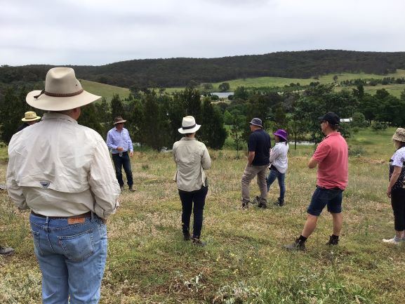
This workshop was held at the Mulloon Institute on the 5 December 2020 (with social distancing). Our guest speakers were Peter Hazell and Anne Gibson from the Mulloon Institute and Jennie Curtis from Roogulli Farm.
What is the water cycle? It can be illustrated by the diagram below.
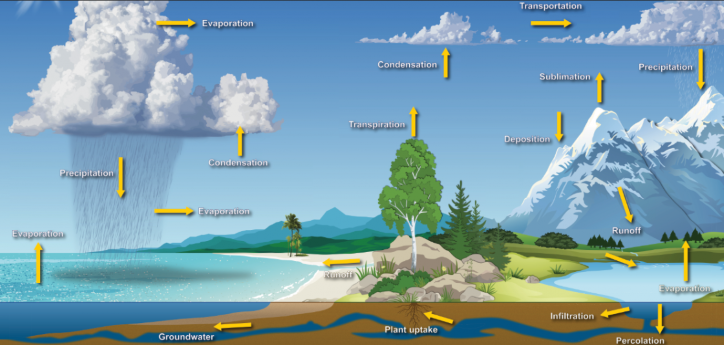
Source: National Oceanic and Atmospheric Administration
The water cycle is essential to life on earth and 65% of rainfall is produced over land.
Peter explained to us that the small water cycle on your farm can be influenced by management. If there is insufficient water in the soil, on its surface and in plants, solar energy cannot be transformed into latent heat that produces water evaporation but is instead changed into sensible heat. The surface of the ground soon overheats, and as a result, a breakdown in the supply of water from the large water cycle arises over the affected land (Source Europeanwater.org). We learnt that farmers can maximise the water potential of their farm by increasing soil carbon, rotational grazing, maintaining ground cover, avoiding bare soil, planting trees, installing simple structures to encourage water infiltration and reducing the effects of erosion.
The Mulloon Institute has been working with local farmers along Mulloon Creek. These are the three main principles of the Mulloon Creek Rehydration Initiative:
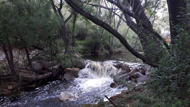
1. De-energise flood waters by putting leaky weir structures in Mulloon Creek. The leaky weirs spread nutrients and water across the flood plain. The recharged ground water is released back into the creek system in times of drought and habitat is created in the resulting chain of ponds. The Mulloon Institute is monitoring the project including stream flows and water quality.
2. Slow the speed of surface water runoff higher in the landscape. At the Mulloon Institute they achieve this in steep areas using swales, leaky weirs and non-permanent structures in first and second order streams. Water energy is dissipated and stored in vegetation below the swales.
3. Increase surface roughness using vegetation, rocks and plants to create niches and microclimates. This conserves water in the landscape, creates habitat for wildlife and potentially increases feed resources for grazing.
Peter described simple ideas such as creating a wetland upstream from a dam or in the inflow area of the dam to catch sediment. He also suggested making brush packs using unwanted plants such as Kunzea and blackberry to place along the contour as small-scale solutions to reducing runoff and improving water quality.
Find out more information about the Mulloon Institute Rehydration Initiative here.
Jennie Curtis is a landscape architect who manages Roogulli Farm in Bywong with her husband Chris. The farm is a mixed enterprise with a Babydoll Southdown sheep stud and a market garden. These are key points from Jennie’s presentation:
1.
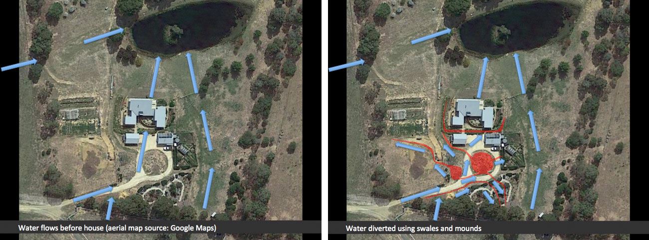
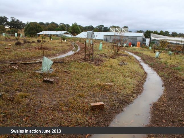
A swale is a ditch or wetland along the contour. It is hard to see a well-designed grassed swale; the cross section should blend smoothly into the surrounding landscape. Swales can be used to redirect water away from structures (drainage) and into places where you want the water to infiltrate the soil. For example, Jennie showed how water flooding the house pad on her farm was redirected into garden areas using swales.
2.
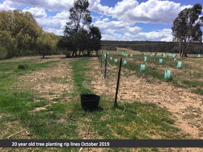
You can rip along the contour to slow the impact of runoff and improve water infiltration rates. A word of caution though, ripping can increase weeds in the short term and in some situations ripping can cause erosion.
3.
Know your levels – use a laser level, survey or water in a clear pipe to measure levels and identify lines along contours since the eye can be deceptive.
4.
After drought or bushfire, water can be slowed by using simple silt fences constructed along the contour using hessian or silt fence fabric secured to star pickets. This can help protect dams and waterways from debris and erosion when vegetated filtration zones are missing in the landscape.
5.
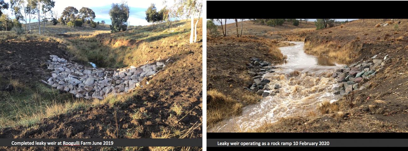
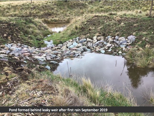
Leaky weirs can be used across drainage lines to slow water flows. The water held temporarily behind the structure has more opportunity to infiltrate the soil and helps protect the area upstream from erosion. These structures need to be designed to be structurally sound and sized to handle the peak water flows found in that flow line. This often requires professional design assistance.
The guiding principles that Jennie uses are:
- Simple solutions can work well
- Deal with the problem near the source
- Know your levels. Slow water by sending it along the contour. Move water by sending it downhill
- Avoid concentrating flows
- Design with maintenance in mind
- Design for easy access (think about how swales will be crossed by vehicles, people and animals).
The placement of structures in water courses requires rigorous engineering and planning. Weirs, rock structures are examples of ‘controlled activities’ that may require a permit and approval. It is wise to check that your contractor is aware of these requirements before building any structures in water courses.
Find out about Water Licencing and Compliance here.
Contact NSW Water Advisory Services on 1800 353 104 or email water.enquiries@dpi.nsw.gov.au.
Resources:
Digital elevation model and contours from Geoscience Australia
Water recovery for the climate: a new water paradigm
Peter Andrews - Natural Sequential Farming
Rivers of Carbon - What are swampy meadows and chains of ponds and why we need them
NSW Local Land Services. Chapter on water in Rural Living Handbook
Small Farms Network Capital Region Irrigation workshop
Small scale ideas for managing erosion
Information on dams, building dams and water on small farms
What is a swale?
Swales? Or Not to Swale?
This event was funded by the NSW Government through an Increasing Resilience to Climate Change (IRCC) Community Grant. You can find out more about the IRCC projects here.